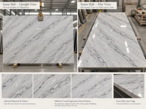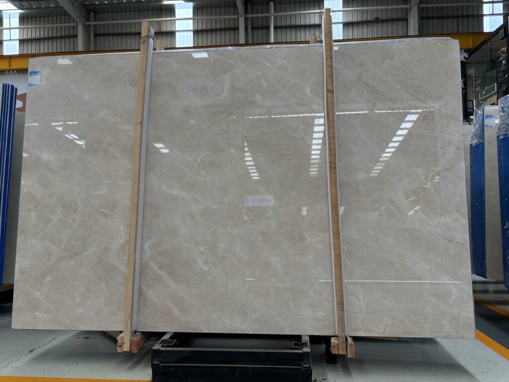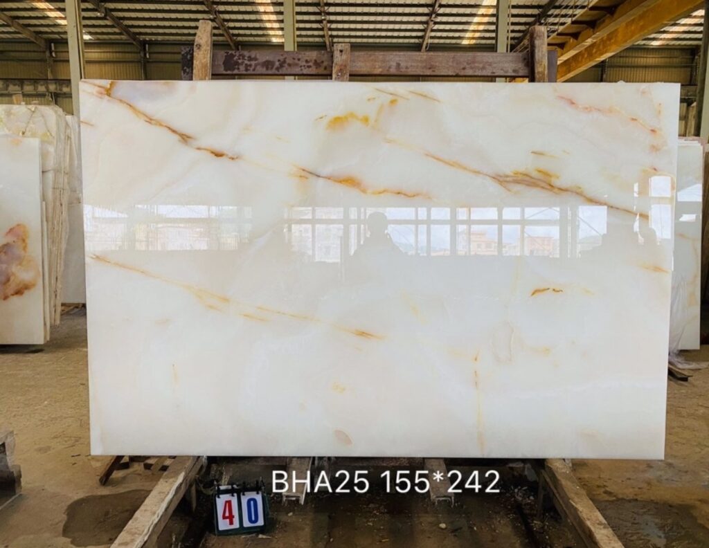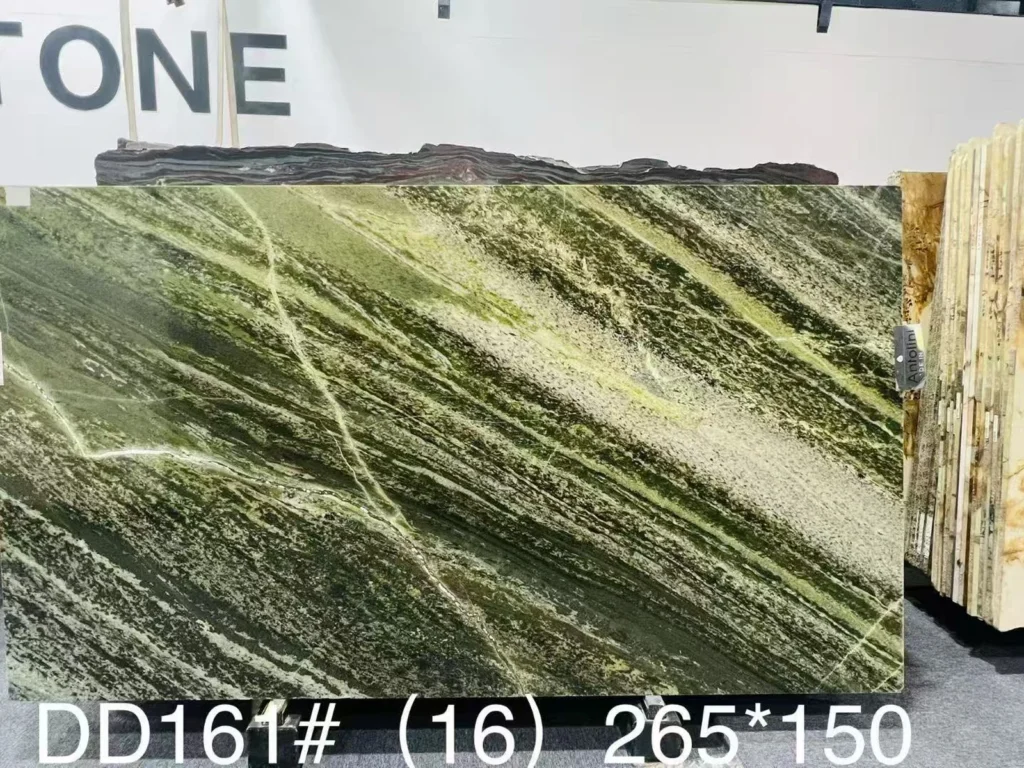

Resumo Rápido
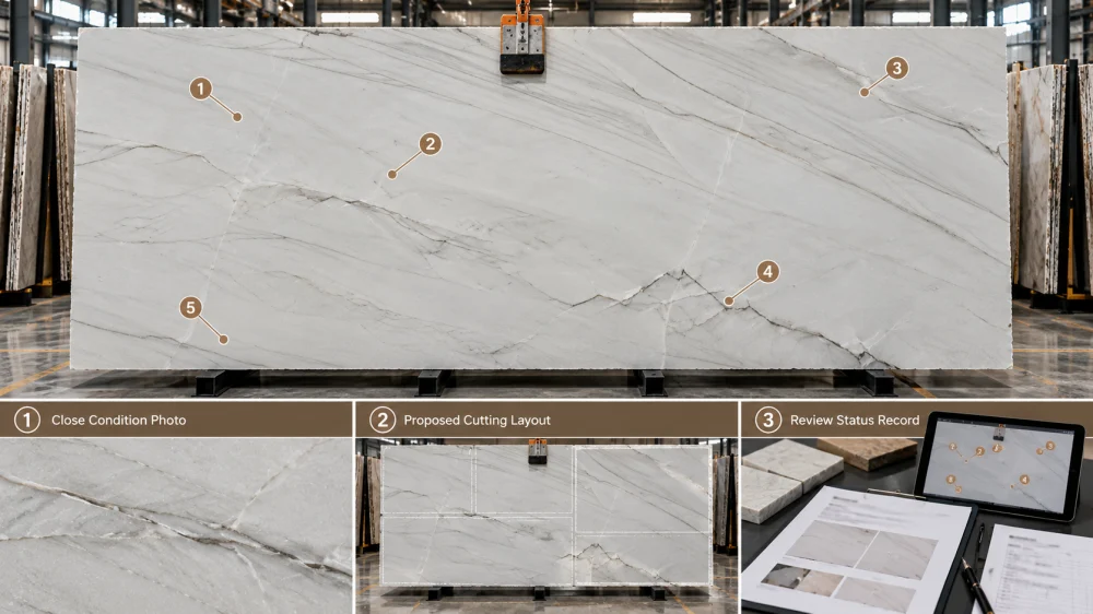
A Quartzite slab condition map should identify one specific slab, establish a consistent viewing orientation, mark observed conditions with stable callout numbers, connect those callouts to photographs, describe observations neutrally, and show which items require layout or fabricator review. When a cutting layout exists, the map becomes more useful by showing where observed conditions fall relative to finished pieces, visible areas, cutouts, edges and waste zones. A condition map is a coordination record—not a geological diagnosis, quality certificate or automatic acceptance decision.
A buyer receives six close-up photographs of a Natural Quartzite slab.
One shows a visible linear feature. Another shows an edge chip. A third shows what appears to be a filled area.
The photographs may be clear, but the project still has a problem:
Where are these conditions on the slab?
Are they close together?
Does one fall inside the future sink opening?
Is another in the middle of the island?
Will the edge condition disappear during trimming?
A Quartzite slab condition map is designed to answer those location questions.
Its purpose is not to label the entire slab “good” or “bad.” It creates a traceable relationship between the physical slab, observed conditions, photographs, proposed finished pieces and unresolved project decisions.
Think of the condition map as one controlled page built around one slab.
FULL SLAB OUTLINE / REFERENCE IMAGE
Top ↑
C-01 C-02 C-03
C-04 C-05
↓ Bottom
This basic structure keeps the map tied to the physical material instead of becoming a collection of unrelated inspection notes.
The first field should answer:
Which physical slab does this map describe?
Useful identification fields can include:
One Slab = One Primary Map
If a project uses several Natural Quartzite slabs, prepare an identifiable condition record for each inspected slab rather than combining all observations under one commercial material name.
“Patagonia Quartzite” identifies a material.
It does not identify which Patagonia Quartzite slab contains condition C-04.
The next problem is orientation.
If one person photographs the slab from the front and another later rotates the image 180 degrees, a note such as “upper-left area” can become meaningless.
The condition map should therefore establish a consistent orientation.
SUPERIOR
Defined according to the controlled full-slab reference.
BOTTOM
Remains consistent across later photographs and layouts.
LEFT / RIGHT
Referenced from the same stated viewing direction.
ORIENTATION MARK
Helps connect photographs, condition map and later cutting layout.
Do not infer precise physical coordinates from a photograph unless the image or record provides an appropriate measurement basis.
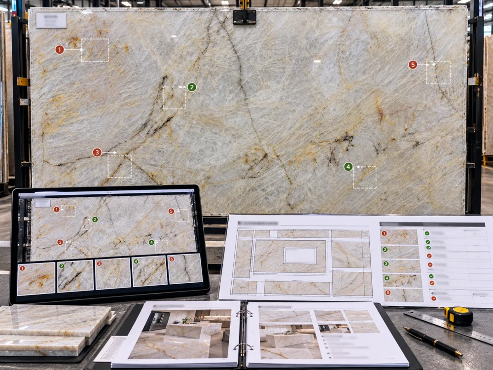
Instead of writing several arrows saying “check here,” assign stable references.
Por exemplo:
C-01 — visible linear condition in upper-left area
C-02 — observed filled area near central zone
C-03 — edge chip at right perimeter
C-04 — strong colour transition
C-05 — area requiring closer photography before classification
The numbering system itself is not important.
Stability is.
If C-03 remains the same observed location after the layout changes, keep referring to it as C-03 rather than renaming the feature every time a drawing is revised.
This is one of the most important rules in a Quartzite slab condition map.
OBSERVATION
“Visible linear condition crossing the marked area.”
UNVERIFIED CONCLUSION
“The slab has a structural crack and will break.”
The first statement records what the inspection can support.
The second makes technical claims that may require information not available from the photograph or visual inspection.
The same principle applies to words such as:
Use precise terminology when the condition is actually known. Otherwise, describe what is visible and identify what needs further review.
A condition map becomes confusing when the observation and the decision are written as if they were the same thing.
| Campo | Example |
| Condition ID | C-04 |
| Observation | Visible filled area in lower-right portion of slab |
| Evidências | Full-slab image + close photograph P-04 |
| Project Decision | Review against proposed island layout before cutting |
| Status | Open — layout review required |
The condition itself does not automatically determine the project action.
Location, finished-piece geometry, visual priority and fabrication context may change what the team decides to do.
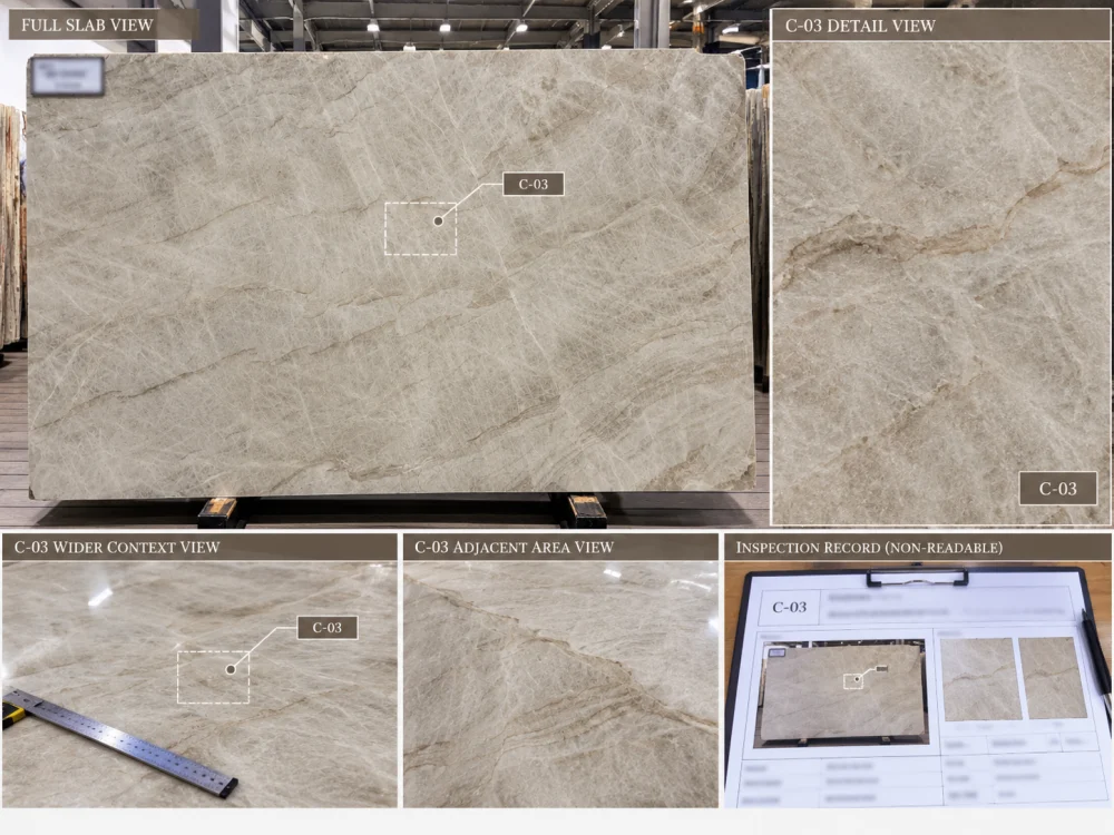
A close-up photograph can show detail very well while showing location very poorly.
That is why a useful photo record has two scales.
A condition photo without a location reference can easily become detached from the slab it is supposed to document.
The legend should be simple enough for buyers, designers and fabricators to interpret consistently.
Depending on the inspection scope, useful categories might include:
Do not create categories that imply the inspection established something it did not actually establish.
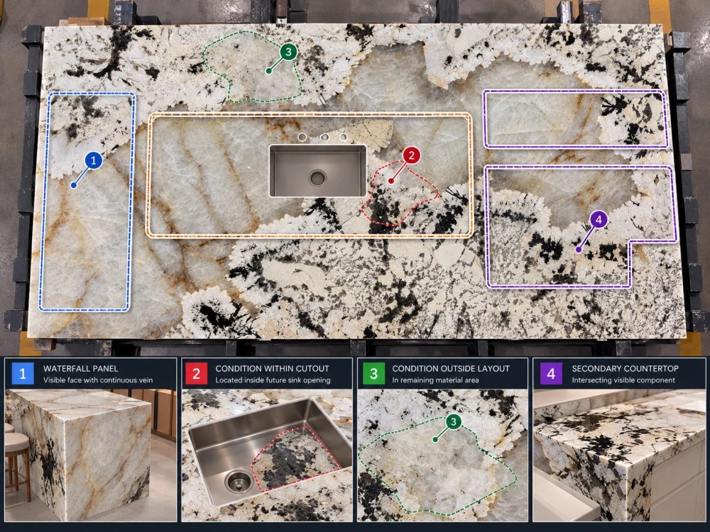
A condition map becomes substantially more useful once the project has a proposed cutting layout.
Now the team can ask a much better question than:
“Does this slab have a condition?”
It can ask:
“Where does C-04 fall relative to the finished project?”
LAYER A — CONDITION MAP
C-01 / C-02 / C-03 / C-04
LAYER B — CUTTING LAYOUT
Island / Waterfall / Vanity / Cutout / Waste / Spare
The result may show that an observed area:
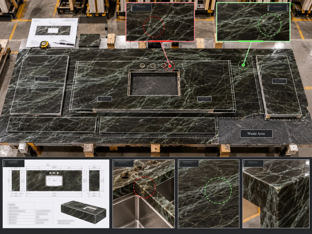
This location-based approach is also important when deciding whether an existing or proposed repair is acceptable. The site’s guidance on acceptable Natural Quartzite repairs similarly connects the actual slab condition to its finished-piece location rather than judging a repair only from an isolated close-up photograph.
A buyer may want to preserve a particular area for:
Marking a HOLD ou MUST FEATURE zone can be useful.
Similarly, the project may mark an AVOID FOR THIS PIECE zone.
Important Distinction
A planning avoidance zone means the project does not currently want a particular finished component placed there. It does not automatically establish that the marked stone is defective, structurally unsuitable or unusable for every other purpose.
Without status, a condition map can become a permanent collection of unanswered arrows.
A simple status vocabulary may include:
INFORMATION ONLY
Observation recorded; no current project action required.
LAYOUT DECISION REQUIRED
The observation needs to be compared with proposed finished-piece placement.
FABRICATOR REVIEW REQUIRED
The condition intersects geometry or processing questions within the responsible fabricator’s scope.
MORE EVIDENCE REQUIRED
Additional photographs, dimensions or physical review are needed.
CLOSED — SEE REVISION
The project has recorded the relevant decision in an identified current document.
A professional condition map does not need to pretend that every observation can be resolved from the first photograph.
Useful notes include:
“Depth cannot be determined from photograph.”
“Back-side condition not shown.”
“Closer image required.”
“Actual dimension to be confirmed.”
“Review against cutting layout after piece position is fixed.”
“Fabricator review required before cutting.”
Visible uncertainty is more useful than unsupported certainty.
A Quartzite slab condition map can document:
What → Where → Evidence → Status
Ele não estabelece automaticamente:
Those questions may require other documents or project-specific professional review.
Suppose condition C-05 initially falls outside the proposed island.
Then the island position moves.
C-05 may now fall directly inside a visible finished component.
The physical slab has not changed.
O project significance of the recorded location has.
REVISION EXAMPLE
Map R01
C-05 recorded → outside current island layout
Drawing Changes
Island position revised
Map / Review R02
Same C-05 → now intersects finished island → new review required
Preserve the earlier record rather than silently replacing it.
They may be overlaid for review, but they answer different questions.
| Condition Map | Layout de corte |
| Where was something observed? | Where are finished components proposed? |
| What evidence documents the observation? | How are pieces allocated to the slab? |
| What review remains open? | What material becomes finished piece, cutout, trim, spare or waste? |
Overlaying the two creates the useful project question:
Condition Location → Cutting Position → Finished Piece → Visible / Fabrication Context
The presence of a mapped condition does not automatically reduce usable slab area.
However, a project decision to keep certain observed areas out of specified finished components can change the available cutting envelope.
For example, several project-specific avoidance zones could:
This is why gross slab area should not automatically be treated as usable cutting area. The related Guia da área utilizável de quartzito natural versus a área bruta da laje explains how project-specific layout constraints can change practical yield.
A — Identity
Material name, exact board/slab ID, project reference.
B — Document Control
Inspection date, map revision, preparation basis and responsible record author/team.
C — Orientation
Full-slab reference, top/bottom/left/right and consistent viewing direction.
D — Stable Condition IDs
C-01, C-02, C-03 or another controlled numbering system.
E — Neutral Observation
What is visibly observed without unsupported diagnosis.
F — Location
Position on the actual slab.
G — Evidence
Full-slab photograph, close image, video or other identified record.
H — Layout Relationship
Finished-piece, cutout, edge, mitre, waste, spare or other relevant zone when the cutting layout exists.
I — Project Action
Information only, layout review, further evidence, fabricator review or another defined action.
J — Status
Open, pending, conditionally reviewed or closed under an identified project record.
K — Revision History
What changed when the map, layout or supporting evidence was updated.
Placa: Identified Natural Quartzite slab
ID da condição: C-07
Localização: Lower-central area on controlled full-slab reference
Observação: Visible linear condition
Evidências: Full-slab image F01 + close image P07
Initial Status: Layout review required
Layout Overlay: Proposed sink opening crosses most of the marked area; remaining portion approaches one finished corner
Next Action: Responsible fabricator to review actual condition and finished geometry before cutting release
Decision Record: To be updated after project-specific review
Notice what this example does not say.
It does not automatically call C-07 a crack.
It does not declare the slab defective.
It does not invent a universal safe distance from the sink.
It makes the physical relationship clear enough for the appropriate project party to review.
Um mapa de condições de uma laje de quartzito é um desenho controlado ou uma imagem da laje inteira marcada, que identifica uma laje específica de quartzito natural e registra as condições observadas por localização, número de chamada estável, evidências de apoio e status de revisão.
Inclua o material e o ID da laje, a referência do projeto, a data de inspeção, a revisão, a orientação uniforme das lajes, as observações numeradas, descrições neutras, referências fotográficas, informações de localização, o status da revisão e, quando disponível, a relação entre as condições observadas e o layout atual de corte.
Quando for necessária a elaboração de um mapa de condições para um projeto, cada laje inspecionada deve permanecer individualmente identificável. A quartzito natural apresenta variações de laje para laje; portanto, o mapa de condições de uma determinada laje não deve ser considerado como evidência para outra laje.
No. A condition map is a project coordination and inspection record. It does not replace a material specification, laboratory test, quality certificate, geological assessment, contractual acceptance procedure or fabricator’s technical review.
Observações visíveis relevantes podem ser mapeadas, mas devem utilizar terminologia respaldada pelas evidências disponíveis. Uma característica natural, uma reparação existente identificada, uma reparação proposta e um reforço de fabricação não devem ser automaticamente tratados como a mesma condição.
O arranjo de corte pode ser sobreposto ou analisado ao lado do mapa de condições, quando necessário. Isso ajuda o projeto a determinar se uma área observada está dentro de uma peça acabada, de um recorte, da borda, de uma junta em esquadria, de uma área de desperdício ou de outro local sensível à fabricação.
Record the limitation rather than guessing. Request additional photographs, dimensions, physical inspection or responsible fabricator review when the missing information affects a project decision.
No. A condition map records an observation and location. The project decision depends on the actual evidence, finished-piece position, visual requirement, fabrication context and applicable project criteria.
Condition Mapping for Natural Quartzite Projects
For condition-sensitive Natural Quartzite orders, HRST STONE can coordinate current full-slab photographs, board references, condition photographs, CAD/shop drawings, cutting layouts, piece IDs, fabrication review records, QC photographs and reinforced fumigated wooden-crate packing around the confirmed project scope. Send Josh the selected material, slab references, current drawings, dimensions, finish, visible areas, cutouts, edge requirements and any project-specific review priorities before cutting release.
© HRST STONE / XIAMEN HRST STONE CO., LTD. Todos os direitos reservados.